
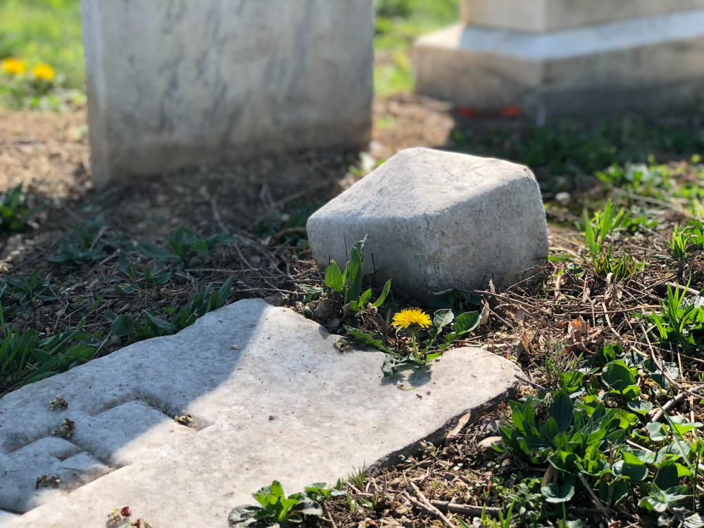
As little yellow flowers started to bloom across the graveyard, honoring every ancestor that breathed life into them, the Spring 2023 semester has come to an end, and it is high time to wrap up everything that has been done to push this project forward until now.

I was stunned momentarily when I stepped into the cemetery. The green and vibrant life spread out before me was so different than when I last visited; everything was bleak and colorless then. I remember wrapping myself tightly in my winter jacket, shuddering against the cold wind. Now I regretted not wearing shorts.
Thanks to Rachel Pretroziello for having already done most of the georeferencing that’s necessary for this project last semester, my goal this semester was to complete most of the site’s data collection by recording the details on the stones, including names, date of birth/deaths, as well as other information included. I first read up on the history of Lincoln Cemetery, using materials compiled by the previous student to gain an understanding of the historical context as well as the current situation of the cemetery. Aside from our main communication via emails, I have also met and kept in contact with SOAL to keep up with the newest developments in order to make necessary changes in the project.
The technology we used is the ArcGIS system, especially the mobile app version to do data collection on-site via phone. With the availability of the Field Maps app, it was much easier and more public-friendly for people to learn how to collect data. I reviewed the digitizing process in this previous post by detailing basic instructions on how to use the ArcGIS Field Maps mobile app for data collection.
Fortunately, we were able to organize a group collection session on Messiah University’s Service Day to speed up the process as the landscape of the cemetery was a considerable size.
Service day

When I reached the cemetery, several different parties of people were on site, including film crews, local news reporters, observing high school students etc. Nevertheless I was glad to see so much active participation from various sources.
The day itself was a long-awaited beautiful sunny day, with a great turnout of more than 30 volunteers. Film crews were rearing to go, people were exchanging conversations with excited voices. Dr. Pettegrew and Dr. Sarvis had arrived earlier to set up lines and flags to make everything easier for data collection. We also planned to have those engaged in data collection work in pairs to add a level of quality control to the process. While we were there, Rachael Williams from SOAL worked with students to expose a previously unknown headstone!

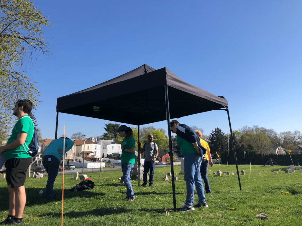

Dr. Pettegrew looking cheery as we start to set up tables, chairs and tents to provide a shady spot to rest under the hot sun.
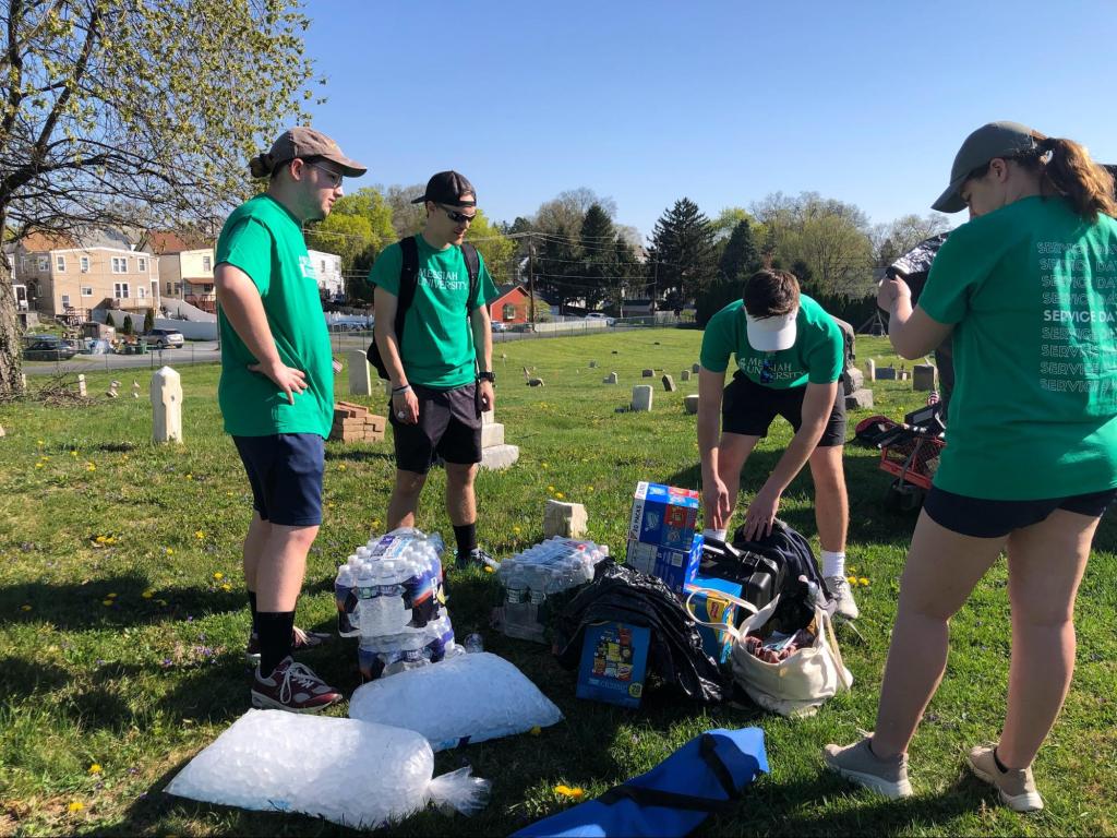
History Club students bringing snacks and water to keep everyone dehydrated. They also captured moments of Service Day which they have gracefully shared with us (link at the end of article).

A moment of me being interviewed by WGAL, a local tv news station covering the work we’re doing in the cemetery and introducing SOAL to the public. Normally I would have shied away but after having made a point in my mind that news coverage has the potential of heightening exposure of the exceptional work SOAL is doing here, I stepped up to the plate (don’t worry I ended up with only 10 seconds of screentime). Despite my inexperience, the reporter and crew were friendly and patient to endure with me.


Rachael Williams from SOAL debriefing us before the data collection commences.


Many activities were happening on-site at the same time; Dr. Sarvis and his team from Harrisburg University testing out their drone were one of them. After a quick set up of their light equipment, they proceeded to fly the drone by a remote control, looking up at the little black speck that buzzed and soared above the cemetery as seen at the very top of the picture below. This would be how the aerial photos of the cemetery were taken back then for the foundation layers of the ArcGIS Field Maps we currently use.

Dr. Sarvis and his team from Harrisburg University shared this dramatic photo of the cemetery from a drone.
The image below shows our progress: blue dots indicate that we captured a photograph of the stone.

We were ecstatic to see the results of everyone’s hard work: it was tremendous progress since this project first started last semester, bringing us closer to our end goal of creating a digital interactive map.
As a result of everyone’s hard work under the sun, the photographs of more than 60% of the identified stones (as a point) have been collected and digitized, currently, roughly more than 200 stones have been uncovered. This is a huge step toward our interactive map of the cemetery that will allow descendants to find their ancestors.
However, this was not without some challenges. As the maps on the app are based on an aerial view of the cemetery, some people had difficulty orienting themselves in the cemetery, which makes it harder to locate the stones correctly. In addition to that, several inaccuracies of points slowed down the progress of capturing data. There were also some random bugs with the mobile app (for example: automatic duplicates along the row, maps not showing up), along with minor Internet connection problems.
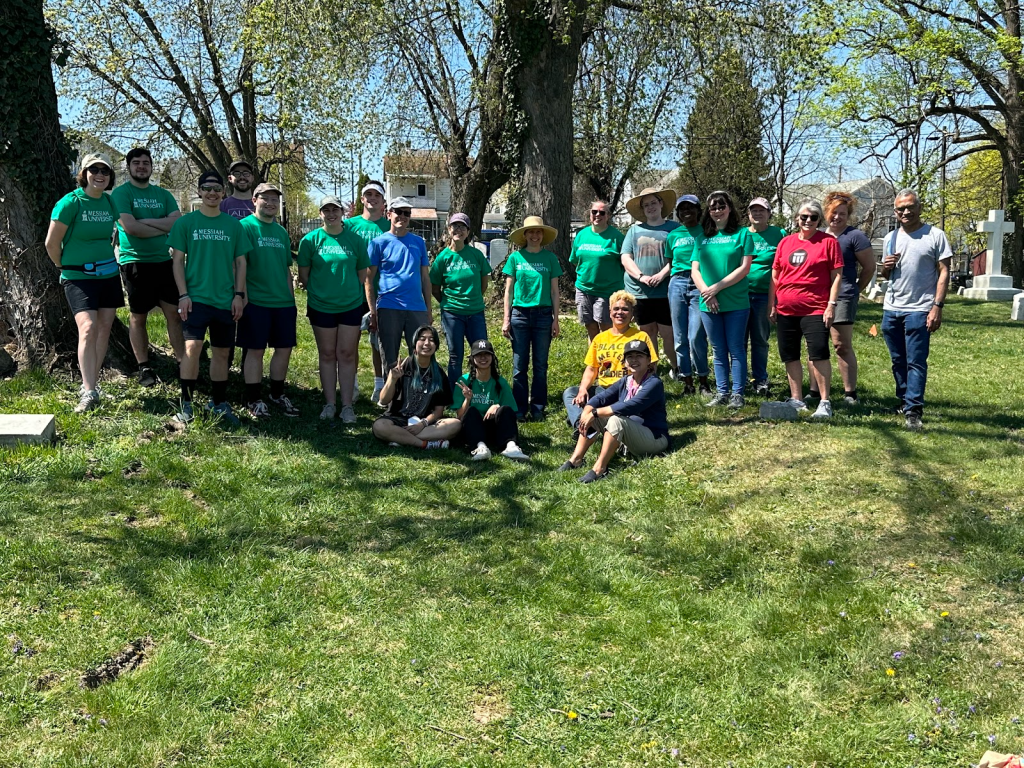
A group photo of some of the people who came together as volunteers for service day. Extremely thankful for all that joined as such progress could not have been possible without them.
For my part of working on the backend (website), relocating and removing points was surprisingly time-consuming as I had to constantly click on every single one to ensure none is left to edit. I also found that the colors indicating points that were already done were rendered irrelevant after my attempt of moving the points to more accurate locations, resulting in a redo of the color indicators.
Next year, we hope to complete data collection on all stones, including many new ones that have been uncovered since the last time the aerial photo was taken, and input the data from the stones so that we can produce the interactive digital map next semester.

A group of student volunteers learning how to collect data on the ArcGIS app from Dr. Pettegrew (in blue shirt).
Once again I am reminded of how easily historically marginalized communities can be lost in the flow of time. Even with intensive and careful research, incentive from the public is crucial as pieces of treasure are now scattered among their homes, deep into the attic of their dusted memories; the intimate corners we could not reach. But this is exactly where a public historian would come in, to figure out how to reach into the public so that both sides work together in harmony and complete the puzzle. Through the process of serving in this project and hearing stories of reconciling families from SOAL, I got the first taste of how my work as an apprentice public historian, in this case on Messiah University’s student team, makes a difference. I hope my contributions to the Lincoln Cemetery project will have a massively positive impact on the Harrisburg community.
Hopefully, the efforts that have been put into this project this semester will help in promoting the publicity and recognition of this meaningful work to the public, and form the bridge for more people to reconnect with their lost pieces of history. This is not the end of this project, but merely the start of the bloom, for more to flourish and thrive.
Links:
SOAL is a non-profit grassroots organization that is doing tremendous work for the community. Any support, whether financially, physically or just spreading the word would be greatly appreciated! If you’re interested in the continuation of the ongoing work on the cemetery, or would like to volunteer on SOAL’s restoration weekends: https://lincolncemetery.org/
Other photos and clips are posted on SOAL’s Facebook page including the excavation of the headstone: https://www.facebook.com/SavingOurAncestorsLegacy/.
Kelan Amme (from History Club) shared the collection of photos and videos of the History Club: https://photos.app.goo.gl/ccV9natRiJ57QNKU9
WGAL News Lincoln Cemetery segment: https://www.wgal.com/article/day-of-service-at-lincoln-cemetery-dauphin-county/43591339
For earlier posts in this series on Harrisburg’s Lincoln Cemetery, see:
- Respect for the Dead at Harrisburg’s Lincoln Cemetery
- Taking the Mobile App to the Lincoln Cemetery: A First Glimpse of Lincoln Cemetery
Passionate about culture, history, social justice, geography, languages, food, and the intersectionality of all this, WenXin Ling is a double major in Sociology and Anthropology as well as Public History, minoring in Digital Public Humanities at Messiah University.

One thought on “Blossoming of Lincoln Cemetery ”